Tag Archives: North America
October 2, 2017

Balmy Barbados

Barbados is one of the southernmost islands in the Caribbean where daytime highs average 75 to 80 degrees, and the air is cooled by constant trade winds. Photo by Gene Korte


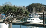
You can imagine, of course, that the beaches are fabulous here.  You even get to choose between the pounding surf of the Atlantic on one side of the island and the gentle waters of the Caribbean on the other.

Perhaps you’ve heard that people don’t really go to this part of the world for the food. That’s not true in Barbados, the only island in the Caribbean with its own Zagat Guide.

If you’re a seafood lover, it’s worth the trip just to taste the locally caught barracuda served at Champers Restaurant and the flying fish at the Waterfront Cafe.

Once the home of a booming sugar cane industry, today this prosperous 14-by-20-mile island hosts plenty of sunbathers, but that’s not all. The other two big draws for Barbados are duty-free shopping and outstanding golf courses. One of the island’s best-kept secrets, however, is 450 years of history made visible through museums, particularly one that opened in the spring of 2008.

GOING DOWN MEMORY LANE

The Arlington House, a jewel of a museum, tells the story of Barbados through visuals, sounds and touch. Situated in an 18th-century coral stone house located in Speightstown, this museum was the home of generations of a merchant family for 200 years.

Surround-sound memories, like a movie soundtrack, and visuals of an olden-times Saturday market day fill the ground floor of this museum. The second floor shows the important role Barbados played in the slave trade. A video of two plantation ladies discussing the sugar in their tea side by side with the comments of the workers in the sugarcane field is a lesson in island economics.

Of the 30 or so island nations in the Caribbean, Barbados is the furthest east and nearly the most southern. Because of that location, hurricanes seldom come to call. Nevertheless, one of the last stops on the third floor, where an electronic pirate has a lot to say, is a display that’s not to be missed. It cleverly demonstrates the sound and fury of hurricane wind.

Barbados is also home to one of the oldest synagogues (built in 1654) in this part of the world. Located in Bridgetown, the Nidhe Israel Synagogue, with its beautiful Gothic arches, has recently been restored and houses an old cemetery on the grounds, along with a museum and a new archeological excavation site. The synagogue is open to the public daily.

GEORGE WASHINGTON SLEPT HERE

When our first president was but a teenager, he came to Barbados with his ailing half-brother Lawrence for a couple of months in 1751. Because of a lung problem, doctors recommended that Lawrence take a trip to the West Indies.

To continue reading this article, go to http://www.ihavenet.com/vacation-travel/Balmy-Barbados-Vacation-Guide-DK.html

© 2011  Diana and Gene Korte

October 5, 2015

Life in Alaska’s Arctic Villages

In a state with few roads, small airstrips become Alaska’s highways.  Photo by Gene Korte


Above that imaginary line called the Arctic Circle the Alaskan wilderness is home to hundreds of miles of lakes and rivers, mountains and forests, but few people.

Airstrips are the only highways up here and the long winters demand resilience. The school in the village of Anaktuvuk Pass, for instance, doesn’t close unless the temperature falls below minus 50 degrees. And in tiny Bettles, our second stop inside the Arctic Circle, an old single-engine floatplane is available to drop travelers into the bush for weeks.

ANAKTUVUK PASS, POPULATION 340

On a sunny Indian summer day we flew into this friendly village on an all-day excursion from Fairbanks. Located 150 miles south of the Arctic Ocean near the Gates of the Arctic National Park, it is the last remaining settlement of the Nunamiut, the inland Inupiat Eskimos. The only sign of civilization that we saw on our flight was the silver colored Alaskan oil pipeline that was installed in the late 1970s. It appears as a double stripe from the air, one line is the pipe and the other is the maintenance road.

For thousands of years the Inupiat Eskimos were nomadic, moving seasonally following the caribou herds. In the mid-20th century a few families gathered in this place to create a new home, and today the village prospers in part because of their portion of Alaska’s oil revenue.

When the tribe first arrived, they came by dog sled. Now they hunt caribou — the herd is estimated to number half a million — on snowmobiles and ATVs. And, though they have more food choices now, caribou is still part of the daily diet for most locals.

The Eskimos’ first dwellings here were sod houses. Now families live in durable heated homes. The town has a water treatment plant, electricity, sewer system, health clinic, police and fire stations, a grocery store, a Presbyterian Church, a U.S. Post Office, even a museum. The Simon Paneak Memorial Museum, http://www.co.north-slope.ak.us/nsb/55.htm, tells the story of these Eskimos. And in a little museum shop residents sell carvings and the caribou skin masks for which the village is widely known.

In the summer months there’s a small restaurant where it’s ESPN all the time, and the cheeseburgers are as tasty as they are down in the lower 48. An estimated 40 percent of the village has access to the internet in their homes, and probably everyone has Dish TV. No alcohol is available in this village and its ban is strictly enforced.

When we arrived, it was sunny and in the 40s. By midday it was well into the 70s and we heard some grumbling about the heat. The village had already experienced cold weather and frost earlier in August and this heat wave was unexpected. The winters, arriving soon, are very cold and the thermometer will stay below zero for months.

There are no roads into or out of Anaktuvuk Pass. Aside from the food (game, fish, wild strawberries and cranberries in a brief season) gathered by the tribe, every item in this town is flown in. During the course of our day here about a dozen planes landed, including small single-engine planes — mostly for hunters — and even a 1940’s era war bird, a C46. Called Dumbo, it flies into air shows in the lower 48, but it landed several times here delivering fuel oil to the village.

Our day trip to Anaktuvuk Pass is a tour offered by Warbelow’s Air Ventures, Inc., http://www.warbelows.com, based at the Fairbanks International Airport. For more information about the people who settled in Anaktuvuk Pass along with mid-20th-century photos of them, read “Nunamiut, Among Alaska’s Inland Eskimos” by Helge Ingstad (The Countryman Press, 1954). In a recent edition it has a new introduction by the former curator of the Anaktuvuk Pass museum.

BETTLES, POPULATION 12

Hunters, fishermen, backpackers and those in search of the Northern Lights come to Bettles, the smallest town in Alaska, for the wilderness experience of the far north. A dozen Japanese visitors, on the hunt for that magnificent light show, the aurora borealis, arrived the days we were here.

The Bettles Lodge, http://www.bettleslodge.com, is listed on the National Registry of Historic Places. Built in the late 1940’s it’s a laidback, casual lodge with good food and conversation, wireless internet and a half-dozen guest rooms reminiscent of what hotel rooms looked like in those old Western movies. A newer building, the Aurora Lodge, has bigger rooms with their own toilets and shower/tubs. And like Anaktuvuk Pass, Bettles has a busy airstrip.

On our last day inside the Arctic Circle, we walked down a dusty road to the Bettles Post Office where a hunter was mailing home caribou horns that he found while in the bush. The postmistress helped him wrap the packages and sent them on their way. Despite their size, the total was only $28 parcel post.

Distributed by Tribune Media Services, INC. for World’s Fare Syndicate and http://www.ihavenet.com

© 2011-2014  Diana and Gene Korte

August 15, 2015

Oshkosh Air Show

Made by the Ford Motor Company, a 1927 Ford Trimotor gets ready for another day of flying passengers at EAA AirVenture in Oshkosh, Wisconsin                   Photo by Gene Korte

Every year in the US there are 450 to 500 air shows, but none is more celebrated than EAA AirVenture Oshkosh. It’s a mecca for homebuilts, experimental planes and those crazy wing-walkers and acrobatic aerial aces.

It’s a state fair kind of place, including booths selling cotton candy,  located near the waters of Lake Winnebago.  Over a week’s time more than a half million visitors arrive, many in campers or as fly-ins in their own planes, with numerous pilots and passengers camping beneath a wing during their stay. No, there aren’t remotely enough motel rooms for everyone in this town of about 65,000. Non-camping visitors rent rooms – like we did – in locals’  homes, in college dorms, or find a place further away. The website helps you do this, http://www.eaa.org.

In Oshkosh there is as much to see on the ground as there is in the air. In the display area of this 1,400-acre aviation hot spot were many old favorites, including hundreds of World War II planes known as Warbirds and the Super Connie, a propeller-powered plane of the 1950s that some enthusiasts consider the most beautiful airliner ever built.

Unlike the fashion attire of suits and ties at the bi-annual Paris Air Show (world’s oldest and largest aviation business event), visitors to Oshkosh are dressed in shorts and T-shirts and hopefully good walking shoes, as there’s so much ground to cover. Families stream in all day. When they’re not looking up to the sky in the afternoon to watch the fly-bys of military planes that make a pass or two and then leave the area or the aerobatic teams, they cruise the big display areas on the grounds.

The 2017 dates for this event are July 24-July 30 at Wittman Regional Airport.

July 1, 2015

Sonoma County USA

Bodega Bay is one of the many scenic stops on the 76-mile Pacific coastline of Sonoma County in northern California. Photo by Gene Korte

Located 30 miles north of San Francisco and next door to the Napa Valley, this area is home to more than 400 wineries, fine Northern California cuisine — flavorful, local, often organic — and miles of dramatic Pacific coastline.

In mid-December, the leaves are just turning colors, temps are in the high 60s and the sky is sunny. And that’s the winter forecast every year, with a tad bit of rain added for variety. Fortunately for visitors, this is also the off-season. So there’s a lot of scenery in and around vineyards, bargains in its many restaurants and small hotels and not much traffic, (www.sonomacounty.com).

For those travelers who come to do more than wine and dine, there are bike and hiking trails, golf courses and state parks, including Jack London State Historic Park (www.jacklondonpark.com), named for one of California’s most famous writers.

For art of a different kind, visit the sculptures on Florence Avenue in Sebastopol. They are one-of-a-kind treasures. It’s there you’ll find the whimsical creations of Patrick Amiot. It seemed every house on that street had one of the sculptures in its front yard. As we turned the corner onto Florence, we had one of those “oh look” moments and suspect many other visitors do, too. See an interview with the artist at https://www.youtube.com/watch?v=wN0neVpHSO0/

April 10, 2014

Battle of Franklin and the Book of the Dead

The Carnton Plantation house in Franklin, Tennesseet,  as seen here from the McGavock Cemetery, was witness to one of the bloodiest battles of the Civil War.      Photo by Gene Korte     


In the waning light of a November 1864 evening, it’s said that the Union soldiers sang hymns while Confederate bands played “Dixie.” Over five hours amidst the cannon booms and cavalry advances, the firing of tens of thousands of muskets and bloody hand-to-hand combat, 9,200 soldiers would lay wounded.

During the last months of the war, the Battle of Franklin, located 16 miles from Nashville, was not the largest fought, but it was the bloodiest. Nearly 50,000 soldiers from 17 states both North and South – three of these contributed soldiers to both sides – met on the battlefield.

As casualties mounted, nearby Carnton Plantation was commandeered as a field hospital. Four of the six Confederate generals who died in this conflict spent their last moments on the porch. The wounded were mostly soldiers from the South, but both they and Union soldiers ended up side by side on the floors of every room, where surgeries and amputations went on nearly round the clock. Carnton Plantation, which has been open to visitors since 1978, still has blood permanently staining the wooden floors.

Carrie McGavock was the mistress of Carnton Plantation at the time of the battle. She and her husband, John, reburied nearly 1,500 of the dead a few years later on their own property, once the owner of the original gravesite announced plans to plow under the burial place of the war dead.

Carrie devoted much of her life to tending these graves, often accompanied by her lifelong friend, Mariah, once a slave and later a free woman. Carrie, who had buried three of her own young children in nearby graves, walked through the cemetery daily, carrying her Book of the Dead. In it was a list of the names, regiments and home states of most of the soldiers who are still buried in the cemetery at Carnton Plantation, known now as the McGavock Confederate Cemetery. To this day, it’s still the largest Confederate cemetery anywhere. A solemn place, the cemetery remains living history, lest we forget, and the gate is always open.

Local Franklin author Robert Hicks memorialized Carrie McGavock and the Carnton Plantation in his novel, “The Widow of the South. ”  Go here for our interview with the author, http://www.prx.org/p/95379.

According to Hicks, Carrie was always known as the Widow of the South in the years after the Civil War. And many newspapers, the New York Times among them, published her obituary in 1905 when she died at age 76. Long a supporter of Carnton Plantation and a member of its board of directors, Hicks works with Franklin’s Charge, www.franklinscharge.com, a group dedicated to reclaiming this Civil War battlefield in its entirety. The American Battlefield Protection Program has called this endeavor “the largest battlefield reclamation in North American history.”

Carnton Plantation, http://www.carnton.org, and the Carter House, http://www.carter-house.org, a farmhouse at the time of the Battle of Franklin, are both open year-round.  The “Battle of Franklin: Five Hours in the Valley of Death” is a 70-minute documentary, http://www.wideawakefilms.com.


Distributed by Tribune Media Services, INC. for World’s Fare Syndicate

© 2012-2014  Diana and Gene Korte